This year, VTDigger is teaming up with Henry’s Weather Channel to help answer the annual question of when and where peak foliage will make its appearance across the state.
Each week, we’ll bring you an updated look at how foliage is unfolding statewide, paired with a weekend forecast, so you can plan your drive, hike or porch-sitting accordingly. Henry brings meteorological experience and on-the-ground reporting with photos and videos from across the region.
A cool September has kicked foliage season into full gear, with high elevations already bright with color.
Here’s what you need to know this weekend.
Mountains are in color and peak is approaching
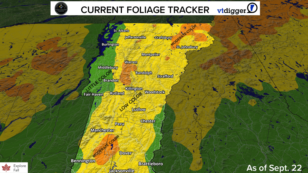
The foliage is really starting to ramp up across the state! Our fall foliage tracker shows moderate color across the Green Mountains and the Northeast Kingdom. To see the brightest foliage, visit the high peaks in southern and central Vermont, or head northeast to Essex County. The leaves have only just started to turn in the lower elevations, but that is currently changing.
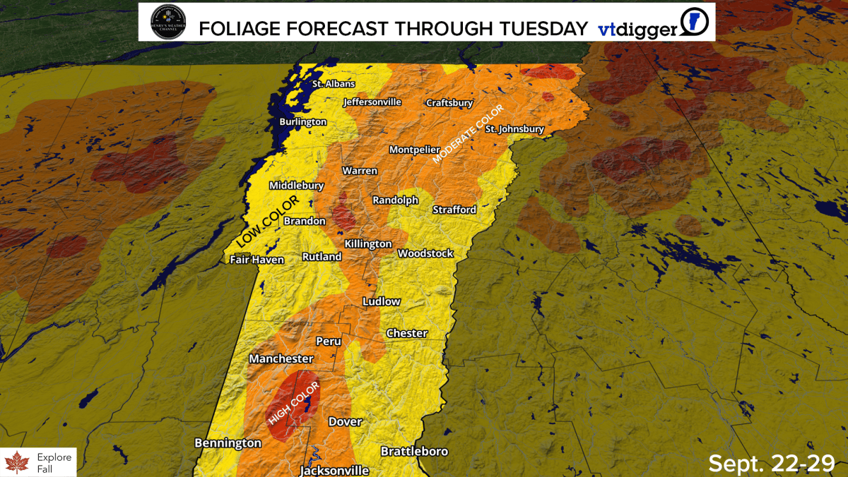
The forecast through Tuesday shows moderate color starting to break out across lower elevations statewide, except in the Champlain and Connecticut River valleys, driven by the cold nights the state has been experiencing. Those same cold temperatures have accelerated the colors at high elevation. With a decent amount of sunshine next week after Monday, expect near peak colors across the Green Mountains by next weekend!
🍁 Know before you go this weekend: Get the statewide foliage and weekend weather outlook delivered to your inbox every Friday this fall, plus our daily Vermont news brief Monday through Saturday.
Rain coming, but we should miss the big storm
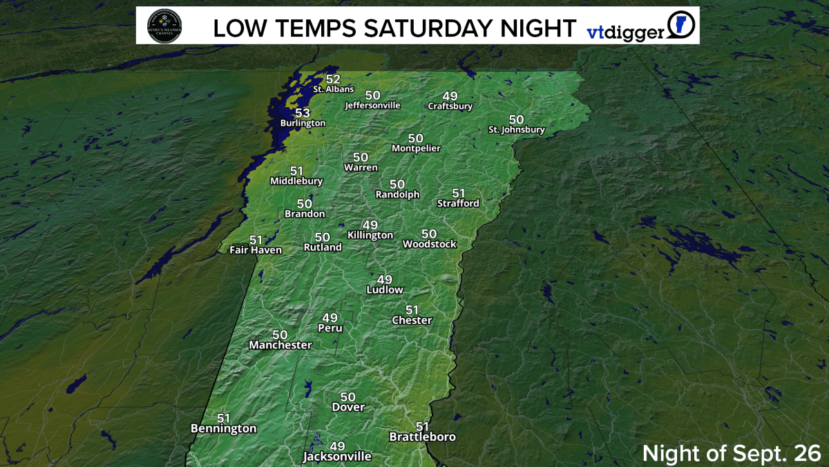
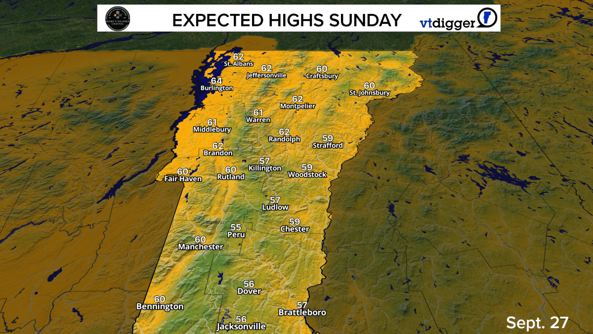
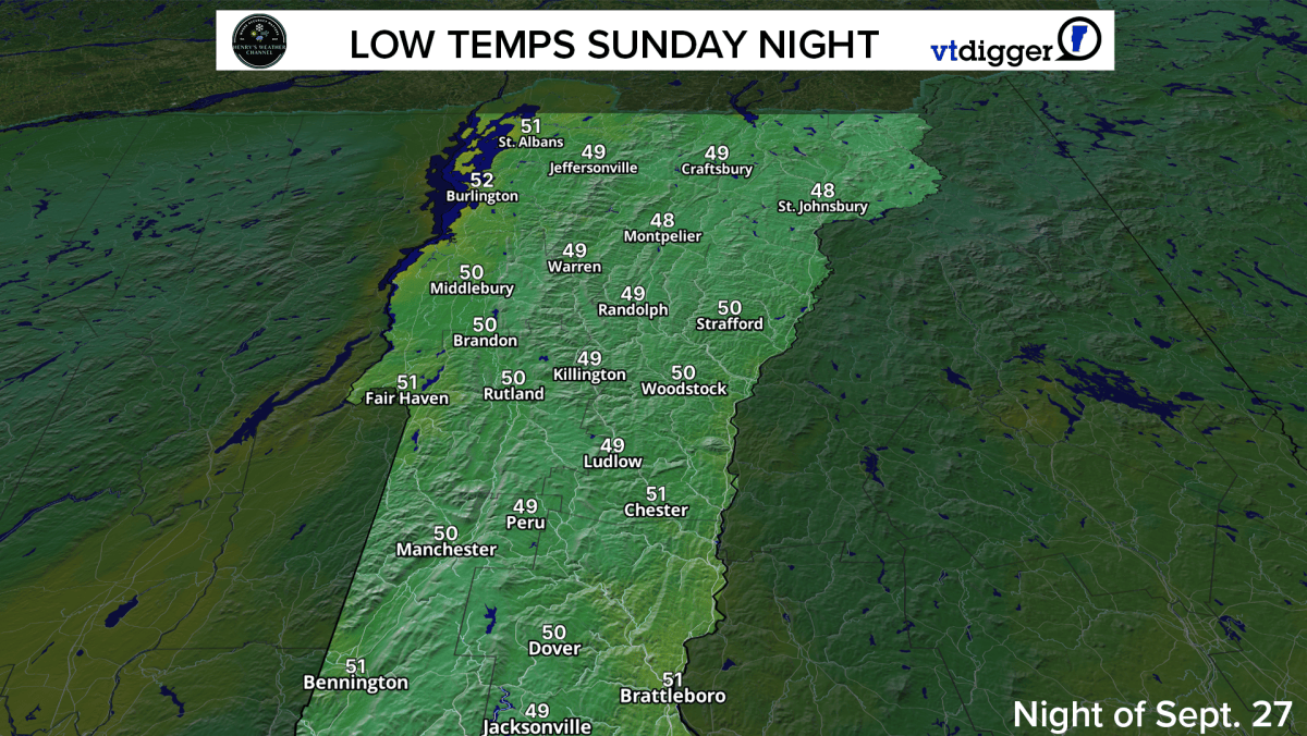
High temperatures this weekend across Vermont will be on the cooler side, as a strong nor’easter passes south of the state. Highs both Saturday and Sunday are expected to be in the upper 50s to low 60s. Low temperatures are expected in the upper 40s to low 50s.

The strong nor’easter this weekend will have limited impact in Vermont but will bring some rain through the weekend. Southern Vermont will see the highest totals. Expect an inch at most — particularly in Windham County — through Monday. Much lower totals are expected elsewhere. Rain will taper off Tuesday when the sun returns!
The storm brings some wind, with 20-25 mph wind gusts but not anything to get worried about across Vermont.
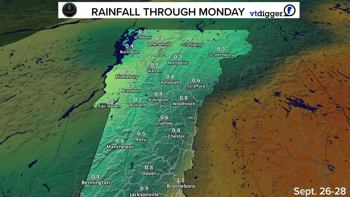
Overall, low impacts from the big storm hitting New England. Clouds and showers will hang around until Monday before improving weather arrives Tuesday. Highs next week look to be in the 60s, but a few days in the 70s look possible.
Show us your foliage
We want to see the foliage from your perspective. Send us your best photos and videos from around Vermont this fall season, and you could see them featured on our website or on our social channels.
By submitting your content and media here, you’re giving VTDigger permission to use your files in our coverage.
This form is now closed. Thank you to those that shared their fall foliage!

Henry Swenson of Henry’s Weather Channel is a self-taught storm chaser, weather forecaster and drone videographer based in New England. He is known for his live storm coverage and tracking and has been delivering accurate weather forecasts to the region since 2017. For this partnership, Henry brings his mobile weather station and boots-on-the-ground approach to track fall foliage as it moves across the state.