


Editor’s note: This story is by Tom Slayton, a Montpelier freelance writer and editor emeritus of Vermont Life magazine. In This State is a weekly feature column about Vermont.
The Winooski River’s 15-mile journey through the heart of the Green Mountains is spectacularly scenic. Dark, stony cliffs and sharp, evergreen-topped peaks rise abruptly from the river, which carves through the mountains from east to west.
It’s also one of the prettiest sections on the Long Trail, the “footpath in the wilderness” that runs the length of Vermont, from Massachusetts to Quebec. Camel’s Hump, one of Vermont’s iconic mountains, can be seen immediately to the south, and the cliffs of Stimson Mountain loom over the river to the north.
However, the Winooski River bisects the Long Trail in Bolton and Duxbury, creating a barrier to foot travel. And so, despite its beauty, the Winooski has posed a tactical conundrum for Long Trail hikers for more than a century.
For three decades after the Long Trail was carved out of the woods, hikers paid 25 cents for a trip across the river on a battered rowboat, manned by a local family. When that service ended in the 1960s, hikers either had to plod 3.5 miles to the nearest highway bridge, in Jonesville, or rely on their own short-term solutions, which included dangerous attempts at wading the river, even crossing on a nearby railroad trestle. The Green Mountain Club, which built and manages the trail, tried several route changes to eliminate the road walk, but no permanent solution ever emerged.
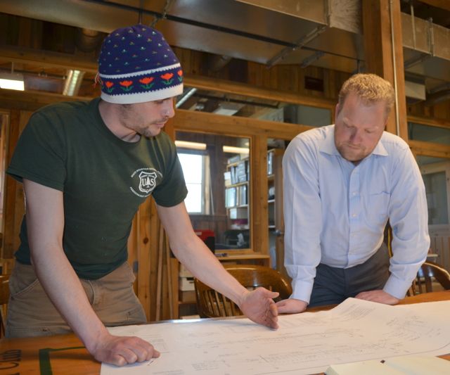
GMC Executive Director Will Wiquist says that finding a direct way to get hikers across the river and eliminating the road walk has been a top priority for a long time. “It’s a no-brainer,” he said recently. “The Long Trail shouldn’t have parts that people want to avoid.”
However, it wasn’t until recent years that several elements came together to make possible what might seem to be an obvious solution – a pedestrian bridge.
Those elements included getting appropriate land for the bridge on north and south banks of the river, having construction technology equal to the job, and raising the substantial amount of money needed. All three are now in hand, and construction is to begin at the end of this month.
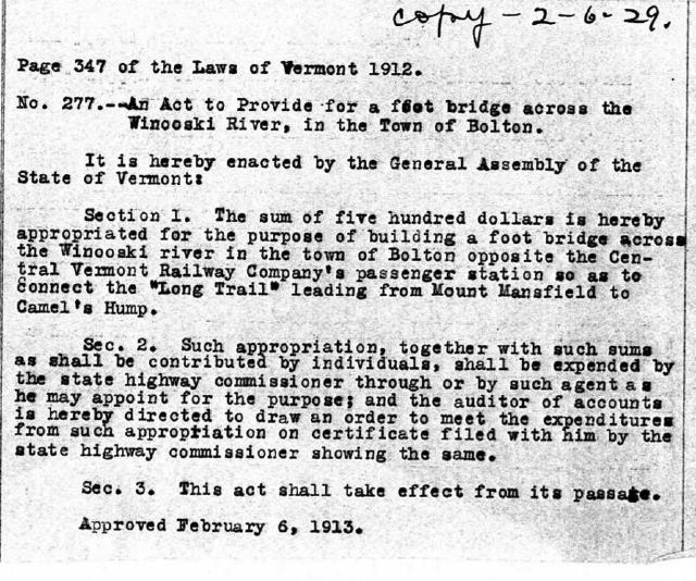
Actually, a hikers’ bridge across the Winooski was seen as a necessity early on, and the Vermont Legislature in 1916 appropriated $500 for the project. Even accounting for inflation, a century later that amount seems laughably insufficient. The estimated cost of the bridge and trail relocation today is $1.6 million.
The club has raised $1.5 million to date, enough to begin the project. Wiquist says that he hopes to raise the remaining $100,000 before the bridge is completed next summer.
The resulting structure will be a 224-foot suspension bridge, the longest bridge on the Long Trail, and twice as long as the GMC’s bridge over the Lamoille River in Johnson. It is the largest trail project the club has undertaken since it constructed the Long Trail itself between 1910 and 1930.
About half the money for the project comes from previous legislative appropriations. Club members, who Wiquist says have been “exceptionally generous,” have donated the rest of the $1.5 million raised to date. Longtime GMC member Daan Zwick of Rochester, N.Y., who was a caretaker on Mount Mansfield in the late 1930s, gave $250,000.
Why was he so generous? The old route over the Jonesville highway bridge compromised one of the prettiest parts of the trail, Zwick said, and he wanted to see it fixed. “I’m a big fan of the Long Trail,” he said.
“I thought that it was a shame to have such a messy way (the long road walk) to get across a pretty part of the Long Trail,” he told the GMC earlier this year.
In a recent phone conversation, Zwick remembered wading across the Winooski one September years ago when the river was low. He became wet up to his waist; a shorter companion was thoroughly drenched.
Wiquist said the new bridge, along with some planned route changes in the Long Trail itself, will make the route through the Winooski Valley safer and more enjoyable.
As the trail descends northward from Camel’s Hump, it will continue to follow Bamforth Ridge, a spectacularly rocky spine with several mini-summits and wide views in all directions. That is the historic route of the Long Trail, designed and built by the determined, slightly eccentric Will S. Monroe, a retired classics professor with a genius for trail building.

Between 1916 and 1926, Monroe, dissatisfied with the lackluster route the trail had followed through the central Green Mountains, relocated and rebuilt it, with the help of several stalwart GMC volunteers. The resulting 30 miles between Middlebury Gap and the Winooski River has since been dubbed “the Monroe Skyline Trail,” and is regarded as one of the most scenic – and most demanding – parts of the trail.
The new footbridge will enable hikers to follow the rocky spine of Bamforth Ridge for most of its length. Below Spruce Knob, which overlooks the Winooski Valley, the trail’s new route will veer westward, angling down toward River Road in Duxbury. But instead of following that road, it will cross it and enter a new section, through fern-filled meadows along the riverbank, eventually reaching the new GMC bridge, and then crossing to the river’s north bank.
There, the trail will cross three further barriers – a grade crossing will be built to get hikers over tracks owned by Rail America (Amtrak), then Route 2 will be crossed, and hikers will proceed under Interstate 89 via the Bolton Notch Road underpass. The new route follows the Notch Road for a short way, then angles steeply past the West Bolton cliffs and up the west side of Stimson Mountain. It will turn north from there and rejoin the present Long Trail on the flank of Bolton Mountain.
Wiquist is enthusiastic about the new section of trail, which he says will add valley diversity to the awe-inspiring rocky descent from Camel’s Hump. “Our membership is so excited about this,” he said. “Nobody liked that road walk.”
There will still be a couple of short sections of road in the new route, but the 3.5 miles of road walk has been reduced to a few hundred yards.
Zwick, the major donor, is 90 years old. He says his goal is to walk across the new bridge when it is completed. Zwick is working to maintain his health and his ability to walk until then.
“I look at it as a form of life insurance,” he said, laughing softly.
