


In 2011, the floodwaters of Tropical Storm Irene left many Woodstock residents without water for five days, destroyed merchandise at the Woodstock Farmers’ Market, and ripped up Route 4, which connects the town to Killington.
In the subsequent years up to the floods of July 2023, Woodstock participated in a project called the Vermont Economic Resiliency Initiative — VERI for short. Coordinators of the initiative identified five towns, including Woodstock, where the state would help coordinate in-depth flood resilience work.
In 2015, the Vermont Agency of Commerce and Community Development published the sprawling, 728-page VERI report, accompanied by individual reports for each of the five municipalities. There, teams identified vulnerabilities, studied flooding patterns and mapped out potential project costs. Using an economic lens, its mission was to help those five towns “rebuild stronger than Irene left us,” as then-Gov. Peter Shumlin said at the time.
More than that, authors hoped the report would provide a framework for other Vermont towns, so that their community members could begin to understand what “rebuilding stronger” actually means, and how they could get there.
A look back at the recommendations from the VERI project — which featured Woodstock, Brattleboro, Brandon, Barre, Enosburg and the Village of Enosburg Falls — shows a complicated picture of climate resilience work already undertaken in Vermont.
Some projects succeeded in reducing the impacts of this summer’s flooding. Others performed exactly as they were supposed to, but didn’t have a significant overall impact on the floodwaters’ warpath in their towns or cities. Some municipalities did not have the capacity to apply for the funding needed to complete the projects.
At first glance, Woodstock suffered as much, if not more, from recent floodwaters as it did during Tropical Storm Irene more than a decade earlier.
Residents went without water for 10 days instead of five. The Woodstock Farmers’ Market closed from July until September. Route 4 was a mess.
So what happened to all of those recommendations from the textbook-length, yearslong VERI project? Ask Peter Fellows — a certified floodplain manager at Two Rivers-Ottauquechee Regional Commission who helped coordinate VERI in all five of the chosen towns, and especially Woodstock — and he’ll tick through a list of projects that Woodstock did, in fact, complete.
“Our historic settlement pattern is along the rivers. We all know that,” he said. “And completely mitigating that — hundreds of years of history — is going to take some time.”
In the coming years, scientists expect Vermont to experience both increased precipitation and more extreme weather events due to climate change. But after Irene, there were doubts that a flood of similar magnitude would hit again so soon.
“I think that’s the big takeaway now,” Fellows said. “We’re like, ‘oh, we’re really either gonna have to really do the work, and flood-proof and move all of our stuff up to 5 feet, or just be prepared for this to happen multiple times. Or just completely get out of the way.”
Chris Cochran, director of community planning and revitalization at the Vermont Department of Housing and Community Development and one of the report’s lead authors, thinks about the resources Vermont will need to adapt.
Vermont has been laser-focused on reducing greenhouse gas emissions, he said, citing the Global Warming Solutions Act of 2020.
“We need to do our part,” he said. “And we need to meet our targets. But Vermont will feel the effects of climate change, whether emissions are zero or negative. And I don’t think we spend as much time and resources as we should to prepare our communities for the changes that we’re seeing right now.”
Flood resilience is a broad goal that is achieved through often-complicated, individualized projects and careful, steady analysis. It’s unrealistic to expect that it would have happened between 2011 and 2023, Cochran said, but Vermont can take meaningful steps forward if the state commits to the work.
“We know how to do this,” Cochran said. “We have the relationships and partnerships to make these things happen.”
Brattleboro: The long game
Twelve years ago, when Irene battered the state, Brattleboro’s Whetstone Brook raged.
Its headwaters took on some of the highest rainfall amounts in Vermont during Irene, and as a result, the river damaged homes, flooded commercial buildings and inundated parts of downtown Brattleboro.
But less than a mile upstream of downtown, a 12-acre lumberyard, surrounded on three sides by the Whetstone, remained completely dry. A sturdy berm protected the land from the river.
While VERI aimed to keep much of Vermont dry, this parcel, the authors reasoned, should flood.
Without the berm, the Whetstone’s rushing waters could spread out over the 12-acre parcel, seep into the soil and slow down. In fact, according to VERI, if the land functioned like a floodplain instead of a walled-off lumber yard, it could significantly reduce local flooding — by as much as 4 to 5 feet.
Removing the berm and converting the land to floodplain topped the report’s list of recommendations for Brattleboro.
“Because our rivers and brooks were managed, straightened, channelized, deepened, they don’t act like normal brooks,” said Brian Bannon, Brattleboro’s hazard mitigation coordinator. “They flow much faster. They erode much more explosively and disastrously.”
Twelve years later — and just weeks after the latest deluge battered Vermont — Bannon and leaders from the Vermont River Conservancy gathered for a celebration and press conference. Finally, they were ready to remove the berm and conserve the land.

“Our aim is to have that level of protection across town,” Bannon said. “So when we have these large events, people can just clear the mud off the parking lots or sweep off the roadways. Nobody will lose their home; nobody will lose their life.”
When it’s finished next spring, the parcel, which will serve as a fairweather park, will feature tiers that descend to the Whetstone Brook, inviting the river to spread into its floodplain during surges. The project managers expect the swollen river to seep into the project area, deposit sediment and slow itself down.
The lowest tier is designed to slow floodwaters during a two-year storm, which has a 50% statistical likelihood of occurring in a given year. Another tier will flood during a 10-year storm, according to Bannon. A 10-year storm has a 10% chance of occurring in a given year.
“We’ve had three 10-year storms this year alone,” he said. “So this will be taking a lot of water.”
But its finalization comes eight years after officials realized how significantly the project could mitigate local flooding.
The parcel’s transformation was not VERI’s only recommendation for the town, and some other significant projects have moved forward. For example, Tri-Park Cooperative Housing Corp. recently finalized funding to relocate dozens of mobile homes in flood-prone areas and complete other flood resilience projects.
Brattleboro did not sustain Irene-level damage during this summer’s deluge. Still, floodwaters wiped out crops, caused problems for mobile homes and closed some roads. Officials assume that the town could have fared even better if the floodplain project had already been completed.
Instead, the former lumberyard again sat dry. So, what took so long?
First, Cersosimo Industries, which owned the lumberyard, had to be ready to sell, said Erin De Vries, co-director of the Vermont River Conservancy. That didn’t happen until 2017.
Then came the challenge of cleaning up the site, which is contaminated with polycyclic aromatic hydrocarbons, a material often found in industrial fill material. The physical cleanup work required burying contaminated soil deep into the ground, safe from the wrath of a raging river.
And the brownfield came with an unusual amount of red tape, according to De Vries. For about two years, the team members engaged in a cost-benefit analysis, trying to understand what kind of contamination existed on the landscape and how they could fix it. They worked with federal agencies, including the Environmental Protection Agency and the Federal Emergency Management Agency, which required lots of testing and a tall stack of paperwork.
Then they needed state approval, including an Act 250 permit, which is typically a time-consuming process. Their project manager from the Environmental Protection Agency died in 2021. In 2022, FEMA told the conservancy that, as a nonprofit, it wasn’t eligible for a grant after all, so the organization transferred the project to the town government.
By the time De Vries listed the Covid-19 pandemic as one of the project’s obstacles, reporters at the press conference chuckled.
Cochran, a lead author of VERI, said flood mitigation projects — particularly the ones with impact — are not easy to pull off.
“VERI was intended to lay out a framework for communities to do the analysis they need to do to make better decisions,” he said. “But it’s complicated work. Communities don’t really have the resources or expertise, and doing this work, to do the analysis, does take time.”
A little more than a week after the Vermont River Conservancy and the town of Brattleboro had secured their final permit, construction vehicles roamed the riverside parcel as the project leaders spoke to the press about Brattleboro’s future.
“People will be able to watch it,” Bannon said. “A 10-year storm will just go by. A 20-year storm — they can just stay in their home.”
Brandon: A renaissance
The Neshobe River has flooded Brandon at least seven times in the last 100 years. Each time, the flooding has looked almost exactly the same.
But during this summer’s flooding, the river stayed well within its banks, leaving downtown Brandon almost untouched.
As in many other Vermont towns, the river flows through Brandon’s center — a relic of another time, when the flow of the water powered mills. After coursing over a waterfall, the Neshobe runs through a canal, created in the 1820s, located under a block of buildings that includes the Brandon town offices.
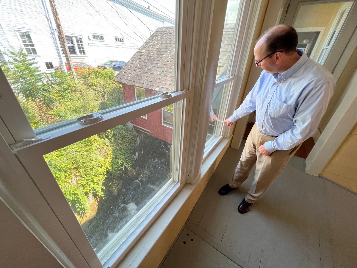
Creating the canal “really restricted its channel,” said Seth Hopkins, Brandon’s town manager. During big storms, the river filled the canal and had nowhere to go except to tumble over Route 7, which runs perpendicular to the water body.
“It was the same kind of damage, over and over again,” he said. “1927, 1938, 1973, 1996, and so on and so forth.”
In 2011, Tropical Storm Irene hit Brandon hard. Ten years later, Gov. Phil Scott visited the town to commemorate the storm’s anniversary. Irene shuttered the town office building for years, closed businesses and lifted a restaurant, Brandon House of Pizza, from its foundation onto the sidewalk and the adjacent Route 7.
After Irene, town officials met with the leaders of VERI. Based on the pattern of flooding, the group knew exactly what needed to change. Brandon’s top-priority project focused on one of the least dazzling but most important tools in the flood mitigation world: a big culvert.
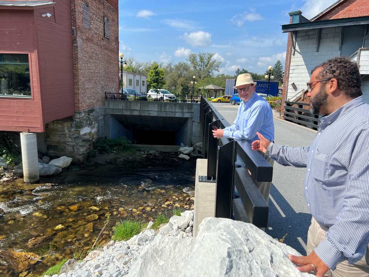
The new system includes a channel that accepts overflow waters from the existing canal, then a giant, box-shaped culvert — 6 feet high, 12 feet wide and 238 feet long — to carry the water safely under Route 7. The two waterways meet on the other side of the road, then continue on their way to the Otter Creek, which eventually empties into Lake Champlain.
In total, the culvert project took less than a year to complete. Finalized in 2017, it kicked off a chapter of construction in Brandon, which included a yearslong project to update Route 7. Covid-19 followed.
Business owners in town “were all anticipating 2020 was going to be this great bounce-back-Brandon year,” Hopkins said. “And it turned out to be like, ‘ready, aim, close,’ because of Covid.”
In recent years, Brandon businesses have been faring well. Several new shops have opened, and only one has closed, unrelated to flooding or Covid-19, according to Hopkins.
Bernie Carr, executive director of the Brandon Area Chamber of Commerce, owns a gift shop near the culvert, across the street from the relocated Brandon House of Pizza. Beginning with Irene, the town’s decade of struggle pushed it through a deeper change, he said.
“Buildings were torn down that had been just garbage for so many years, and Café Provence got built in its place,” he said, referring to the restaurant that has been a magnet for visitors and residents alike. “That was the beginning of our renaissance, really.”
Another severe flooding episode might have caused another chapter of strife for downtown. But this summer, while water rushed through the culvert, nearly filling it, the river didn’t overflow.
The night Brandon received the most rain — a few days later than many other Vermont towns — a group of people gathered downtown near the culvert to sing and play music and stayed late into the night, Carr said.
“We’re all watching this, like, ‘Is this going to keep getting worse?’ Because you know, sometimes you just have to wait for the watershed to come down through. You have the extra rain,” he said.
“It just handled it perfectly.”
Enosburgh: The agricultural town
The picture is more complicated in Enosburgh and the Village of Enosburg Falls, which are separate municipalities but taken together in the VERI report. Some projects have moved forward, and others haven’t.
One spot near Boston Post Road, a bridge over the Missisquoi River, is consistently closed due to flooding, said Bethany Remmers, assistant director of the Northwest Regional Planning Commission, who helped coordinate the report.
“One of the recommendations in the report is looking at options for either a replacement of that bridge to make it longer in order to better accommodate both high water flows and ice jams that consistently happen there,” she said. “Nothing’s happened yet, but the project is getting a little bit more traction.”
Franklin County didn’t see many impacts during the July storm, and both Enosburgh and the village fared well, but the summer storm still closed the road. Remmers said she could see the project moving forward in the next five to 10 years.
VERI estimated the project would cost more than $1 million. The town of Enosburgh tried a lower-cost workaround to see if it could install more culverts instead of fully replacing the bridge, but engineers determined the proposal wouldn’t solve the problem.
Enosburgh, which has a selectboard but no town manager or town administrator, has tried to go through FEMA for several projects, Remmers said, but has not been successful.
The FEMA process can be difficult for smaller communities, she said. There’s a high bar for the available funding, and the cost-benefit analysis of the application process “can be difficult,” Remmers said. “It’s very labor-intensive, and then the local match is very difficult for some communities to provide.”
The Village of Enosburg Falls is more at risk from aging stormwater infrastructure than river flooding, Remmers said, and VERI primarily addressed river flooding. A few days after the July 10 rainstorm, the village received several inches of rain within a half-hour, she said, causing streets to flood.
“That’s just kind of that case in point,” she said. “We need to get our head around the stormwater infrastructure. How do we help communities upgrade that? Because that’s going to be a really important part moving forward, and being resilient.”
Enosburg Falls did move forward with a project to improve drainage around Hayes Farm, Remmers noted. In VERI, the Enosburgh area represented a town with agricultural roots, and its section of the report focused partly on making the agricultural economy more resilient.
“Currently, a lot of the farm-to-market truck routes for milk or other goods are vulnerable to flooding,” Remmers said.
Outside of VERI, Remmers said, climate resilience work is incorporated into almost every aspect of her job at the planning commission.
“It’s impacting all of our discussions,” she said. “Land use — we need housing. Where do we need that housing to be? Our energy planning — it’s touching everything.”
Barre: ‘This time, it really needs to be different’
In Barre, one of the communities hardest-hit by the July storm, several VERI projects functioned exactly as their design intended. The report focused on the area surrounding Gunners Brook, on the northeast side of Barre, “because of the unusually high level of development adjacent to the channel, significant economic activity, and history of repeated flooding and flood damages,” the report states.
Using $500,000 in state hazard mitigation grants, the city purchased several flood-damaged properties near the brook, according to Cochran, who coordinated VERI.
Then, the city turned the bought-out properties to floodplain and installed two “trash racks” — pilings driven 20 feet deep into the ground and extending about 8 feet above the water — to catch woody debris that might have otherwise clogged culverts and the river channel, flooding the downtown area.
Thom Lauzon, who now sits on the Barre City Council, was the city’s mayor during Tropical Storm Irene and worked closely with VERI project managers.
“During this latest storm, it functioned exactly as designed,” he said, referring to the trash racks.
After the flood, the trash racks were “quite a sight,” Lauzon said. The project almost looked as if it had been destroyed, but engineers told Lauzon that it looked exactly as it was supposed to: full of debris.
While some of the houses near the project flooded, “simply because of the water volume,” he said, they’re still standing.
“The brook still swelled, and the brook still overflowed its banks in places, but that was a function of water volume, not a function of an inability to manage debris,” he said. “So we managed the debris that came from other towns and cities, and we caught the debris in the flood area exactly as it was designed.”
Meanwhile, much of the flooding took place along North Main Street, which runs alongside the Stevens Branch of the Winooski River.
“We just didn’t do enough,” Lauzon said.
The project cost “a tick over a million dollars,” he said, and at the time, it was one of the largest flood mitigation projects in Washington County.
“Now, we’re talking about projects that could easily be in the tens of millions of dollars,” he said.
While the project was a success, it’s an example of work that needs to be expanded in Barre, Lauzon said. FEMA data shows that 600 reports of damage were made in the city, and the area has faced an unprecedented number of landslides.
“As a state and as a region, we allowed ourselves to turn away from mitigation and focus on other problems,” Lauzon said. “And the other problems are important. I’m not saying they’re not. But I think we all recognize that this time, it really needs to be different.”
Woodstock: No easy solutions
Patrick Crowl, owner of the Woodstock Farmers’ Market, gave himself a five-year deadline to move the store to a different location after Irene.
“Well, that didn’t happen,” he said. “You know, the bloom wears off after time. Are you really gonna have another 500-year event?”
Twelve years later, the store is still in the same spot, sandwiched between the Ottauquechee River and Route 4, a road busy enough to keep the high-end grocery store bustling.
But after this summer’s floods, the market had to shut down for months. Having recently reopened, Crowl said the emotional toll of the flood has been lasting, and he’s not sure he could handle flood No. 3.
After Irene, VERI recommended that the market flood-proof its building. Crowl moved forward with several projects — raising compressors and other machinery off the ground, for example, he said. Still, the floodwaters wreaked havoc.
“When you get 2 to 5 feet of water inside a building, and the river rises 40 feet up off the bottom of the river, there’s really not much you can do,” he said.
Crowl isn’t sure what to do next. The market has another location in Waterbury, which remained steady and bolstered the business while the Woodstock shop remained closed. Still, answers for the future are “kind of murky,” he said. He finds himself weighing the options.
He thinks the state needs to band together and come up with a comprehensive program to handle flood mitigation — something that would deeply consider all of Vermont’s river valley communities. But he’s not holding his breath for someone to come knocking with an easy solution.
“We’re not going to put a wall up,” he said. “We’re not going to put it on stilts. So what do you do? Do you move from the location? Do you change the use of this property? Do you sell it to the state or somebody else that might want it? All of that is still up in the air. But I think it’s really up to us, as entrepreneurs. I don’t think anybody’s going to be out there banging my door down for a comprehensive flood program.”
In broader Woodstock, several VERI projects moved forward. The Vermont Agency of Transportation made improvements along Route 4, but the agency has completed even more work since the July floods, said Fellows, the planner with the Two Rivers-Ottauquechee Regional Commission.
Some of Woodstock’s infrastructure fared better than in Irene, said Eric Duffy, the town’s municipal manager.
“None of our bridges were severely damaged, unlike Irene,” Duffy said. “So I think that was very helpful. None of our sewer lines were impacted, unlike Irene, so I think when they redid them after Irene, that was very helpful.”
But some infrastructure fared worse. One of VERI’s major recommendations for Woodstock reads, “relocate or reinforce drinking water line owned by Woodstock Aqueduct Company.”
Flooding from Irene caused Woodstock’s primary water supply line to rupture, which left 1,600 residences and businesses without water for five days, according to the report.
“While the water supply lines were upgraded following the flood, more work is needed to improve the system’s reliability during major floods,” the 2015 report stated.
In July flooding, two water main breaks left residents across town without water for 10 days, Duffy said. Woodstock Aqueduct System is privately owned, which means it is not eligible for FEMA assistance or some other types of public money, according to Vermont Public, but its owners are looking to sell the system to the town.
And other VERI projects, like floodplain conservation near the Riverside Mobile Home Park, were not completed.
Fellows isn’t surprised that some of the items on VERI’s recommended to-do list remain unchecked.
“Twelve years is nothing in terms of even small infrastructure projects, especially at a town level, based on small-town Vermont capacity. I mean, 12 years is nothing,” he said. “We have grants that can run from initial idea to completion — easily 10 to 20 years.”
“It’s getting out from under the new climate regime and our historic settlement pattern,” he said. “It’s not going to happen in two floods.”

