
Updated at 6:57 p.m.
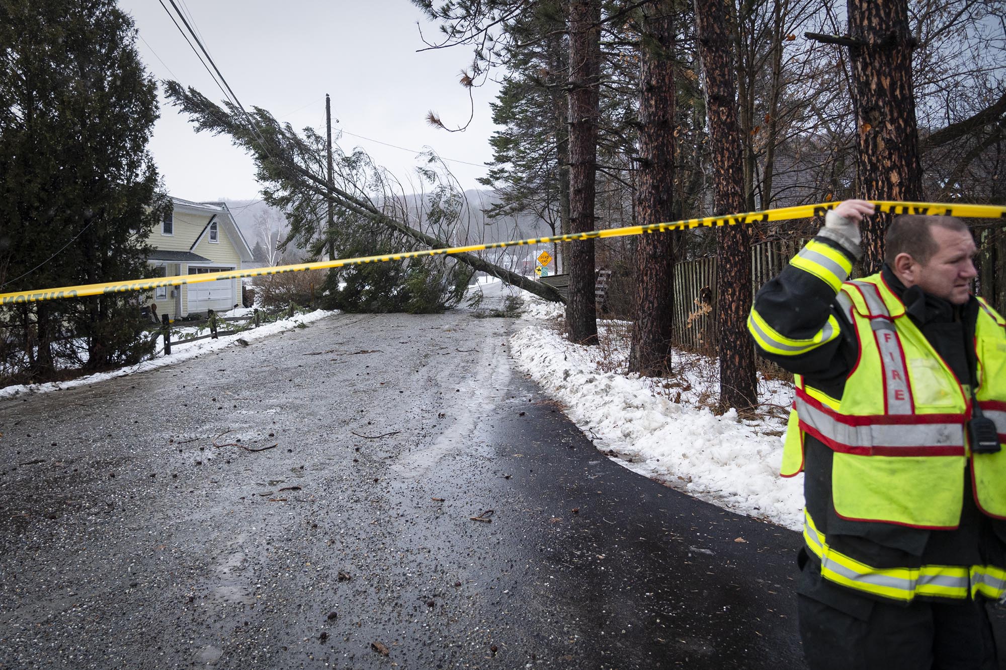
Vermont settled in for an icy Friday night marked by dangerous road conditions after powerful wind gusts toppled trees, killed at least one person and left thousands without power.
Temperatures were forecast to drop “like a rock” Friday afternoon, according to Secretary of Transportation Joe Flynn, leading to dangerous driving conditions starting around 4 p.m. He and other state officials urged Vermonters to stay off the roads overnight.
“You need to be where you are going to be tonight by 4 p.m.,” Public Safety Commissioner Jennifer Morrison said at a press briefing Friday morning in Waterbury. “After that, all bets are off and you are taking a tremendous risk.”
In Castleton, a falling tree killed a 51-year-old woman Friday morning, the Rutland Herald first reported. Police did not release her identity.
Erica Bornemann, director of Vermont Emergency Management, said she was not aware of any other injuries or fatalities related to the storm.
At peak, Friday’s wind caused more than 75,000 outages, making it the second or third worst storm in the last 15 or 20 years, Bornemann said Friday afternoon. Nearly 50,000 households and other customers remained without power heading into the evening.
“We’re really excited to see how quickly restorations are happening,” she said, but “it’s definitely a possibility that we’ll see some Vermonters without power on Christmas, unfortunately.”
“This is unique from other storms,” Gov. Phil Scott said at Friday morning’s briefing. “Having a little bit of snow, a lot of rain, and then the severity of the temperature drop. That’s what’s keeping me up at night.”
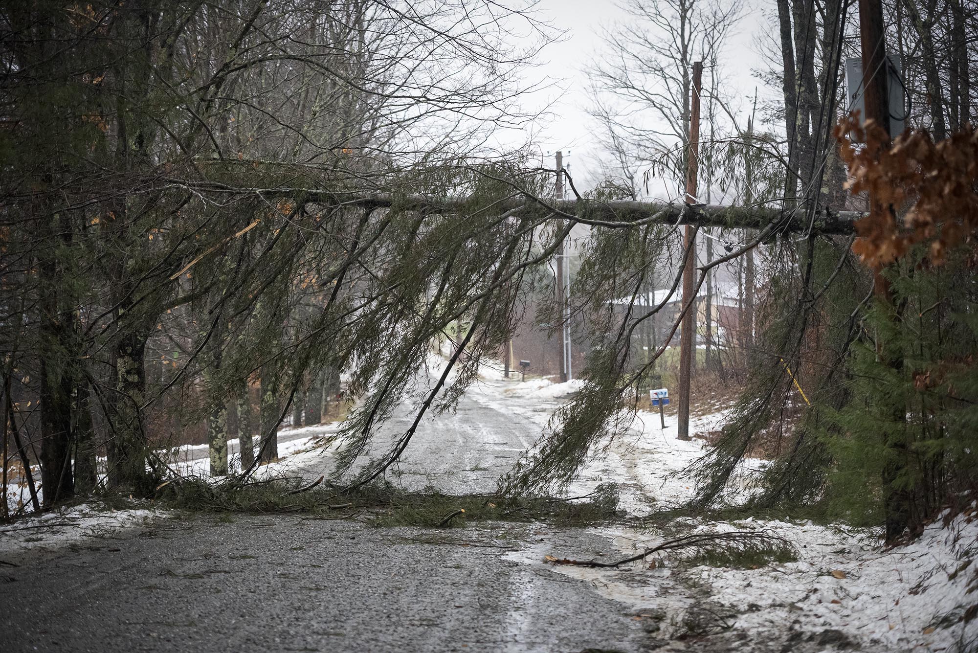
The storm barreled through Vermont Friday morning with wind gusts of up to 70 miles per hour, according to the National Weather Service. It hit the western side of the state most heavily, particularly the western slopes of the Green Mountains, but gusts in central Vermont and the Montpelier area were more intense than expected, Bornemann said.
A 70-mile-per-hour wind gust clocked in Burlington on Friday was “a tie for the second highest we’ve ever recorded here at the station,” said Peter Banacos, a meteorologist with the National Weather Service in Burlington. The highest gusts were recorded during Hurricane Hazel in 1954.
Atop Mount Mansfield, Vermont’s highest peak, gusts reached 130 miles per hour.
But the threat shifted over the course of the day from high winds to plunging temperatures, leading to a “flash freeze” forecasted to persist overnight. In Burlington, temperatures were expected to drop from higher than 40 degrees Fahrenheit down to the teens by Saturday morning, Banacos said.
The cold front will likely be accompanied by a very brief burst of heavy snow, he said, “and then as the temperatures fall, you’re going to (see) kind of an icy condition form very rapidly on the roads.”
Bornemann on Friday afternoon said officials continued to urge Vermonters to stay off the road, as the storm had tracked mostly in line with expectations thus far.

Earlier, state officials repeatedly described the storm and its aftermath as “a multi-day event” and said that the state’s emergency operations center had been activated.
They also warned that dropping temperatures could imperil people experiencing extended power outages, encouraging Vermonters to seek shelter and look out for their neighbors.
“The power’s going to be off for quite a while for some people, and it’s going to be very cold on the back end of this system,” Bornemann said. Vermont Emergency Management planned to share shelter resources on its website, she said.
Officials also reminded Vermonters to avoid building fires in dangerous places and to ensure that generators are well-ventilated.
Flooding, a concern before the storm began, turned out to be “nothing really severe,” Bornemann said Friday afternoon. She expected waters to slowly subside.
High winds and dangerous roads led ski mountains such as Killington Resort and Stowe Mountain Resort to shut down operations on Friday. The wet weather will also decrease the snowpack statewide. Magic Mountain in Londonderry, which opened following last week’s snowstorm, expected to remain closed until Monday following Friday’s rain.
Several large trees were down in Winooski, including across the roads off of Lafountain Street, where power lines bowed low to the ground under their weight. As they left the scene, city workers said there was little they could do to fix the situation without Green Mountain Power’s help. The utility was tied up in other areas of Chittenden County, they said.
A short walk away, another tree lay across power lines near the Leclair Street home of Todd Crosby. While Crosby’s power was working, the utility pole outside his home had cracked and bent, and he wondered how long it would be before the situation could be resolved.
“I guess everybody here is just wondering, what’s Christmas going to shape up to be?” he said.
In Essex Junction, some vehicles honked as they navigated a four-way intersection on the busy Susie Wilson Road without the help of a traffic light. High winds had ripped a nearby traffic signal to the ground, destroying it, and caused the other connected light to stop working. Officials at the scene were working to restore both lights.
“We’ve had similar problems all over town and throughout the Junction,” said Essex Police Cpl. Brett Williger, who was at the scene. “Power outages — it trips the breakers, it trips the junction boxes.”
Drivers should be vigilant, Williger said, and echoed state officials’ warnings to stay off the roads Friday evening as freezing conditions begin.
“It’s going to be a whole other story,” he said. “It’s going to get bad.”
The so-called “bomb cyclone” covered the Great Lakes region with snow and caused freezing temperatures across much of the country. Front-end snow blanketed parts of Vermont Thursday night before warm air turned the precipitation to rain.
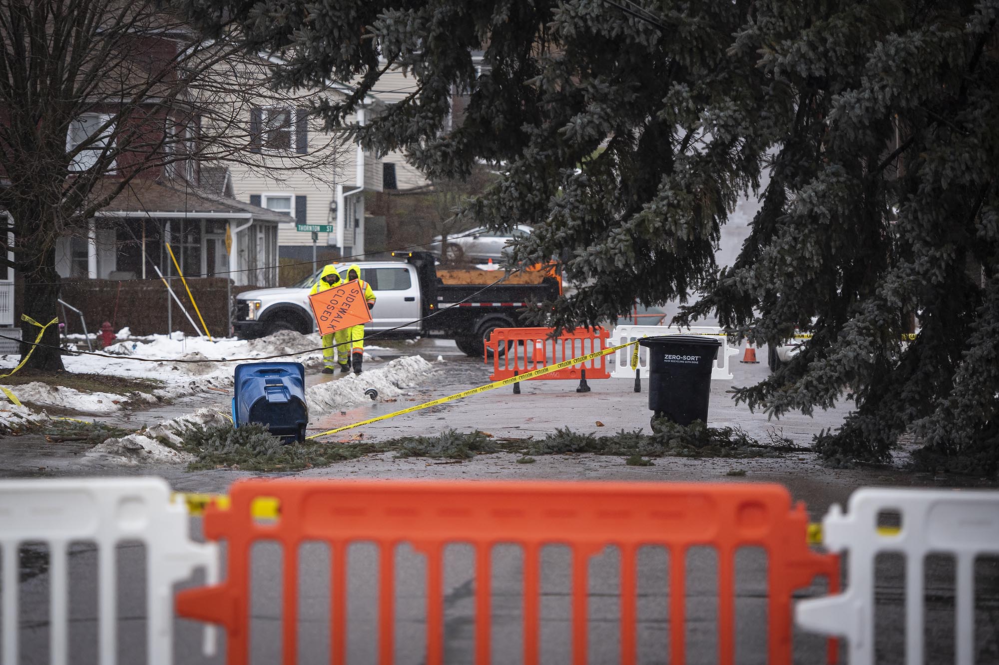
The storm shut down a number of roads across the state due to downed trees and other hazards, including Route 7 in New Haven, Route 5 in Norwich and Route 30 in Wells, according to the state Agency of Transportation and the National Weather Service. Authorities continued to report new closures into the evening, including Route 11/30 in Manchester due to white-out conditions.
According to Mari McClure, president and CEO of Green Mountain Power, the state’s largest electrical utility had tripled the number of lineworkers available in preparation for the storm, positioning crews across the state to respond to outages.
As of 2:45 p.m., the utility had restored service to 39,500 homes and businesses, with 43,500 customers still without power, it said.

Despite the winds, some flights were still coming in and out of Burlington International Airport Friday morning, according to Nic Longo, director of aviation, though others had been canceled or delayed.
“We saw this storm coming, so a lot of folks were able to leave yesterday,” Longo said, pointing to increased travel on Thursday. He encouraged travelers to check the status of their flights frequently.
It’s wind gusts, Longo said, that “make it very difficult for pilots.” On the flip side, he hoped wind will dry off surfaces once the rain stops, minimizing a freeze Friday evening.
Once temperatures drop, it will be all hands on deck readying the runways. Five 75-foot trucks equipped with plows, sweepers and air blowers, plus copious amounts of melting agents are “able to peel off some of this ice,” Longo said.
Scott said that all non-essential state offices would close at 1 p.m. on Friday and continued to urge state workers to work from home, if possible. He encouraged other employers to follow the state’s lead and enable workers to leave early.
Vermont’s retailers typically count on solid sales before Christmas, according to Erin Sigrist, president of the Vermont Retail & Grocers Association. Because the storm arrived on “one of the busiest shopping days before the Christmas holiday,” she said, they “will most likely take a hit.”
But, Sigrist added, “retailers are obviously more concerned with the safety of their customers and employees than those last-minute sales.”
Thankfully, she said, many businesses have reported a solid shopping season so far this year. “It’s just part of doing business in Vermont.”
Much of downtown Montpelier was dark for hours on the day before Christmas Eve, as thousands of capital residents and business owners were without power citywide midday. But a line still formed at Wilaiwan’s Kitchen on State Street, where staff served customers through use of a gas stove.
Shortly before 1 p.m., cashier Shannon Kelly was describing the fun of serving customers warm food amid the blackout when the power, at least for the moment, flicked back on.

Warming shelters
Shelter information for Friday, Dec. 23, provided by Vermont Emergency Management:
Norwich Public Safety Building — 10 Hazen Street — Hours vary
Richmond Town Offices — 203 Bridge St. — Closing 4 p.m.
Shelburne Town Center Gym — 5420 Shelburne Road — Hours vary
Fayston Town Hall — 866 North Fayston Rd. — Closing 6 p.m.
Bennington Vermont National Guard Warming Shelter — 100 Franklin Ln. — 2 p.m.-6 p.m.
Swanton Vermont National Guard Warming Shelter — 13 Ferris St. — 2 p.m.-6 p.m.
Barre Auditorium — 20 Auditorium Hill — Opens at 6 p.m.
Williston Vermont National Guard Warming Shelter — 7846 Williston Rd. — 8 a.m.-6 p.m.
Vergennes Vermont National Guard Warming Shelter — 37 Monkton Rd. — 8 a.m.-6 p.m.
Newport Vermont National Guard Warming Shelter — 540 Union St. — 8 a.m.-6 p.m.
Lyndonville National Guard Warming Shelter — 73 Highgate St. — 8 a.m.-6 p.m.
Enosburg Falls Junior/Senior High School — 65 Dickenson Ave. — Hours vary
Erin Petenko contributed reporting.