


When Tropical Storm Irene hit Vermont in 2011, one piece of wreckage stood out: the state’s waterlogged office complex in Waterbury, which ironically housed Vermont’s emergency operations center.
At a cost of $130 million, the largest state construction project in history, the complex was rebuilt with future floods in mind. Flood-prone buildings were removed, and those that were reconstructed were elevated to survive a 500-year-flood. It worked: State officials have reported no damage at the complex during last week’s catastrophic flooding, which once again inundated Waterbury.
“When you look at the aerial imagery of that space, you’ll see both the road and the parking lots were inundated with water — but the buildings were fine,” Jennifer Fitch, the commissioner of buildings and general services, said Tuesday.
This is not to say that there were no disruptions. Fearful that state employees would be stranded if they remained in the complex, public safety officials, including the state’s emergency operations center, were sent home early on July 10 and worked remotely for 18 hours before relocating to work at the Dill Building in Berlin, which houses the Agency of Transportation.
State officials have repeatedly pushed back at the press’ characterization of this event as an “evacuation,” emphasizing that the building itself remained safe the entire time. But a week later, the state’s emergency operations remain at Dill. Vermont Emergency Management spokesperson Mark Bosma said Tuesday that while they are not concerned about the offices themselves, roads in Waterbury remain in doubt with more rain and flash flooding in the forecast. They’ll re-evaluate after this weekend’s predicted storms, he added.
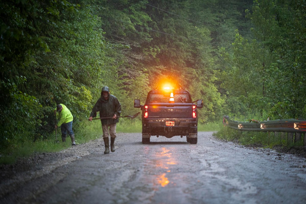
The state’s experience in Waterbury echoes a theme reported by state and local officials up and down Vermont. Amid the devastation, there are innumerable examples of how post-Irene resiliency planning and projects made a real difference when disaster struck anew. But so much of Vermont’s essential commercial, residential, and public infrastructure remains in harm’s way — and there is ample evidence that more floods will come.
“The proximity of our road and railways to water courses continues to pose a challenge when these rivers and streams reach bankfull and either cause tremendous erosion, damage culverts or isolate communities,” Vermont State Climatologist Lesley-Ann Dupigny-Giroux, a professor in the University of Vermont’s department of Geography and Geosciences, wrote in an email.
Responding to a query from VTDigger over the weekend about a landslide in Ripton, Timothy Hanson, a selectboard member and road commissioner, offered a survey of the damage and then this parting thought.
“The very good news is that areas the Town invested in by installing larger culverts, stone-lined ditches and so on held up very well,” he wrote. “It pays to do the work, but it is very costly.”
Neale Lunderville, who served as the state’s first recovery officer after Irene, said in an interview last week that preliminary reports suggested that the state’s transportation infrastructure had fared much better this time around. That’s probably partly because the storms were different — Irene happened all at once, which meant faster, stronger waters, whereas last week’s flooding was much more spread out in time.
“But I think a lot of it has to do with the fact that after Irene, Vermont built back smarter and updated its bridge and culvert design and improved construction to make bridges and culverts and roadways more resilient,” said Lunderville, who is now CEO of VGS, an energy company.
Lunderville was echoed by Pat Ross, an engineer in the Agency of Transportation’s incident command center, although he, too, noted that Irene and last week’s storms brought different types of flooding.
“We’re seeing less infrastructure damage,” he said. “And it appears that we’re seeing more inundation damages to private individuals and businesses around the state from just the waters coming up and then spilling out of their banks and spilling into the floodplains.”
Hundreds of years of building practices have narrowed Vermont’s streams and rivers, making them deeper, faster — and more dangerous during flood events. And so when the state got to work rebuilding its roads after Irene, Ross said it took care to “pinch” waterways as little as possible.
“One of the big things we’ve learned is that you really need to give the rivers and streams room to spread out during these extreme events,” he said.
Building back smarter required tussling with the feds — sometimes for years. The state adopted new codes that required new culverts and bridges be built “to a higher and yes, more expensive but more resilient standard,” recalled Sue Minter, who served as the state’s Irene recovery officer after Lunderville. But the Federal Emergency Management Agency, which supplied most funding for local roads, refused to pay.
“FEMA was telling the towns that they would only reimburse them for what had been there before. So there was this enormous funding gap,” said Minter, who now helms Capstone Community Action, an anti-poverty nonprofit.
Preliminary figures appear to suggest the state’s efforts paid off. Irene significantly damaged about 500 miles of state roads. But a week out from this July’s storm, Amy Tatko, director of communications and public outreach at the Vermont Agency of Transportation reported Tuesday that 232 miles of roadway, once closed, were already reopened. Only 21 miles were down to one lane, and another 27 miles are still closed. (These tallies do not include local roads, which also took a hit.)

Still, if Vermont’s public infrastructure fared better, that does not mean that it escaped unscathed. Johnson’s wastewater treatment plant was completely destroyed, a town official told VTDigger. And 32 other plants suffered damage or disruptions, prompting some officials to question whether such infrastructure should be rebuilt in flood-prone areas. Twenty state buildings in Montpelier alone sustained some sort of flood damage, according to Fitch. The worst will probably be in 133 State Street, which houses the tax department and, coincidentally, Buildings and General Services. The flooding was contained to the sub-basement, but that’s where key building systems were housed — including the electrical, heating, and HVAC systems.
Ross also notes that Vermont’s roads remain vulnerable and are due for some expensive maintenance — soon. The interstate system was essentially all built at once. That means many culverts and pipes under the roadway are more than half a century old “and their birthdays are basically at the same time.”
“We’re not talking about 100 culverts here,” he said. “We’re talking about thousands and thousands.”
It’s still unknown how damage to homes this time will compare to Vermont’s experience with Irene. About 1,000 homes were lost in the tropical storm, according to one state report. State officials have not yet compiled figures about the number of homes damaged or destroyed this July, or the households displaced. But as with Irene, damage to manufactured home communities once again appears to be extensive and severe.
In Irene’s wake, Vermont used a mix of funds to create a state buyout program for private properties that remained in harm’s way, and ultimately purchased 150 homes and businesses, most of which were residential properties. That helped save those families who participated from financial ruin, prevented households from rebuilding in dangerous areas, and helped restore flood plains that then protected other nearby homes and businesses.
Kevin Geiger, who helped run the program for 11 years, thinks the state will need to figure out how to get money from the buyout program to households much more quickly. The process often took years and with that long to wait, many families simply sold, at bargain-basement prices, to whoever else would buy. Or they attempted to “renormalize,” by rebuilding as quickly as possible, and telling themselves that having been struck by lightning once, such a tragedy would not occur again.
But that’s not how floodplains work. Geiger, the planning director for the Two Rivers-Ottauquechee Regional Commission, recalled how several families who had initially declined buyout offers returned to the program after being flooded out a second time.
Asked if Vermont should again turn to this program after last week’s events, Geiger replied that, in his view, the program should be maintained “forever.”
“That’s the hard part for some people to grasp — is we have built our way into an emergency by building in flood zones and next to cute streams, where we thought that it was pleasant to hear the brook out back,” he said. “It’s a little like lead paint, is my latest analogy. At a certain point, that seemed like a bright idea. But it wasn’t a bright idea.”
Disclosure: Neale Lunderville is a board member of the Vermont Journalism Trust, the parent organization of VTDigger.
