
Updated at 9:12 p.m.
MONTPELIER — After a worrisome day in which thousands of residents in Vermont’s capital kept close watch on water levels at a nearby dam, city officials announced Tuesday night that they did not expect a breach.
“The Wrightsville Dam water level is beginning to recede and is not anticipated to breach the spillway,” they wrote in a public update at 8:30 p.m. “In the event of an unlikely release of water, the lower levels of the (north branch of the Winooski River) would now be able to accommodate any excess water without causing more damage.”
Starting in the predawn hours, leaders had warned that the dam on the Middlesex-Montpelier line could reach capacity, forcing it to release water into the river upstream of Vermont’s capital and exacerbating significant flooding downtown.
Even as floodwater started to recede by mid-morning, officials said the threat remained into the early evening. From early to late afternoon, according to official reports, the water level was roughly one foot short of the dam’s top — rising rapidly over the prior eight hours.

In the early afternoon, Stephanie Brackin, spokesperson for the Agency of Natural Resources, said a member of the Department of Environmental Conservation’s dam safety program had told her that the rate of increase in the water level had slowed considerably.
“We’re just not going to know until we know,” Brackin said at that time. “There could be a little spillage. There could be a lot.”
She said that any spillage would not necessarily equate to a dam failure. “If there is some kind of water release, it’s part of the dam structure. It doesn’t mean it’s failing,” she said.
In a post to the Montpelier Police Department’s Facebook page in the morning, city officials said “every additional foot of water that goes over the spillway doubles the amount of water entering the City from the dam.”
An emergency health order closing the area was scheduled through noon Tuesday but extended until 3 p.m. because the water’s retreat was taking longer than expected, they said.
In his initial post announcing the potential breach, City Manager William Fraser said the situation had no comparison.
“This has never happened since the dam was built so there is no precedent for potential damage,” Fraser wrote in a statement posted to Montpelier’s Facebook page at 3:53 a.m. “There would be a large amount of water coming into Montpelier which would drastically add to the existing flood damage.”
At that time, Fraser wrote that the dam had six feet of storage capacity remaining.
By about 9 a.m., according to Montpelier Fire Chief Robert Gowans, the dam had “about another three feet … before it would go over the spillway.”
Around 10:30 a.m., signs that downtown floodwater was receding were becoming visible throughout the area. At a home at the intersection of Cedar and School streets, the water had retreated to the sidewalk, where it had once lapped the front walkway. At an East State Street commercial building, too, previously flooded windowsills were uncovered, with neighbors estimating the water had dropped by a foot.

Still, danger lingered. Fraser wrote that if water “exceeds capacity,” the first spillway would release water into the north branch of the Winooski River. People who live along that branch and in downtown Montpelier were at greatest risk, he said.
With “few evacuation options remaining,” Fraser wrote, “People in at risk areas may wish to go to upper floors in their houses.”
Owned and operated by the state Department of Environmental Conservation, the 115-foot-high Wrightsville Dam was built in 1935. It’s located about three miles north of the city center.
On Tuesday afternoon, National Guard spokesperson Mikel Arcovitch said the Guard would send a team of 25 quick response troopers on Humvees and tactical vehicles into Montpelier. They also had helicopters that were going to be conducting search and rescue operations and assessing the situation on the ground.
“We do and go wherever the state needs us to go,” he said. “So it sounds like Montpelier is the place at this time.”
But Gowans, the fire chief, said he was surprised to learn that the Guard was coming, and said “we don’t need them in Montpelier.” He pointed out that the water was receding and the sun was out.
He said his team was waiting to get into the flooded areas to see the damage and check for potential safety risks from electrical short circuits.
It was not immediately clear whether the Guard personnel made it to the capital.
In a morning press release, Montpelier police Chief Eric Nordenson said that first responders were “spread very thin.” He urged people to call 911 only “in an extreme emergency.”
He said his officers had relocated to the Berlin Water Treatment Plant, located uphill, because the department’s basement, city hall and the fire department were flooded.
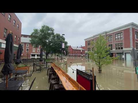
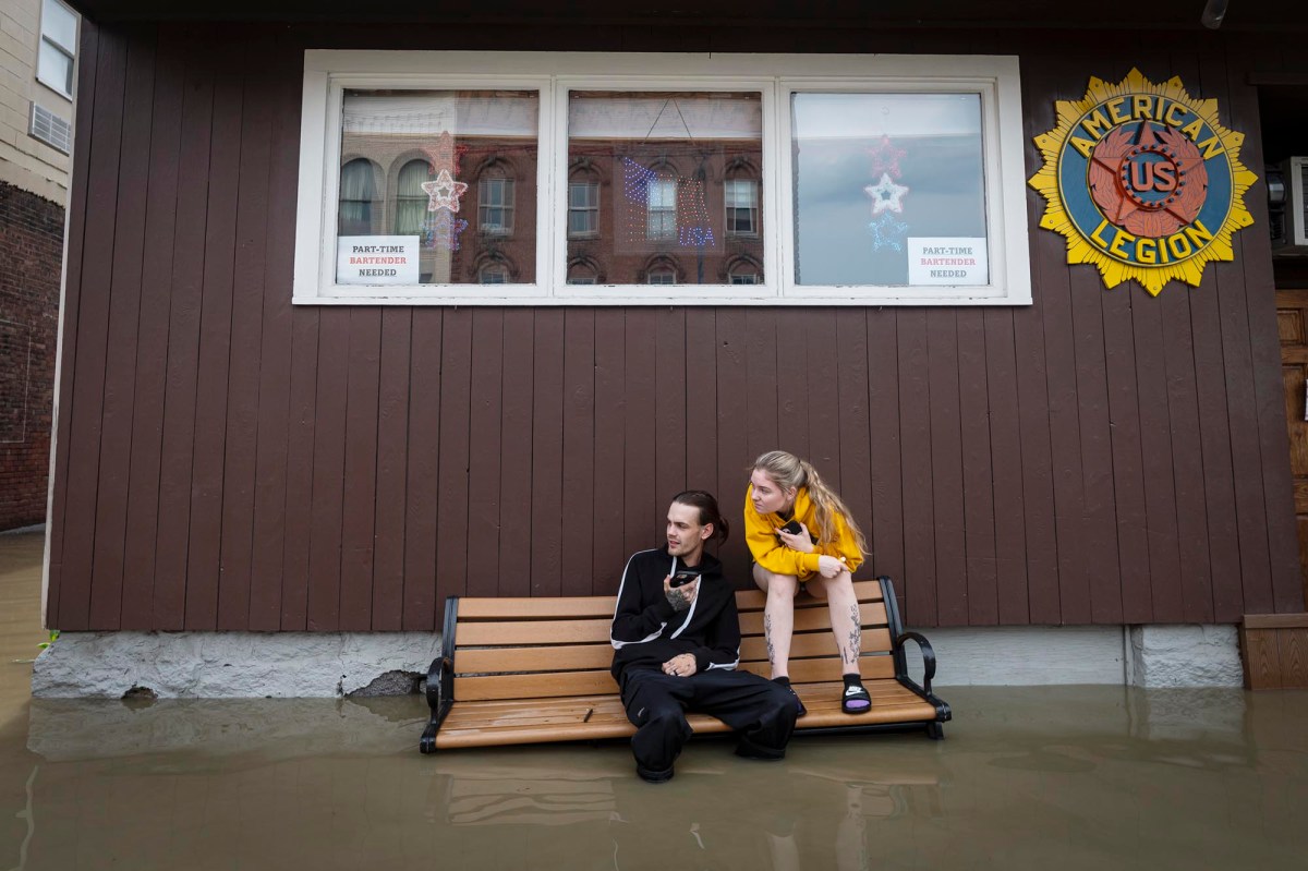
Several feet of water lined the streets of Montpelier on Tuesday morning, smelling of gasoline. A strong current flowed down State Street past the Statehouse. Alarms blared.
The National Weather Service issued a flash flood warning at 5:46 a.m. It said 0.75 to 1.5 inches of rain had fallen over the previous two hours and that another half-inch to an inch was expected through 7 a.m.
Montpelier’s downtown city streets were already underwater Monday evening. According to the weather service, the city set a daily rainfall record of 5.28 inches Monday, breaking the previous record of 0.94 inches set in 1989.

As of 5:45 a.m. Tuesday, the weather service said, the Winooski River had reached 20.58 feet in Montpelier. Major flood stage is considered 17.5 feet. During Tropical Storm Irene in 2011, the river reached 19.05 feet. The record was set at 27.1 feet during the devastating flood of November 1927.
Lola Duffort, Fred Thys and Paul Heintz contributed reporting.
Correction: A previous version of this story misstated the Montpelier daily rainfall record that was set in 1989 and broken on July 10, 2023.