Updated at 5:44 p.m.
WHITE RIVER JUNCTION — Hartford emergency officials have advised residents living near the White River to “evacuate uphill,” according to a press release from the Hartford Emergency Communications Center.
“This is an extremely dangerous situation and will equal (Tropical Storm) Irene in 2011 and the 1927 flood,” officials wrote in a Facebook post around 2:30 p.m. on Monday. “If you live, work, or travel near the White River evacuate uphill now!”
They predicted portions of Routes 14 and 107 “will be covered and will be damaged or destroyed,” with widespread flooding in low-elevation fields and neighborhoods.
Among those watching the river on Monday afternoon were Willard Hashimoto and his dog, Oreo, who often go to the Watson Upper Valley Dog Park along Route 14, about a mile west of the village.

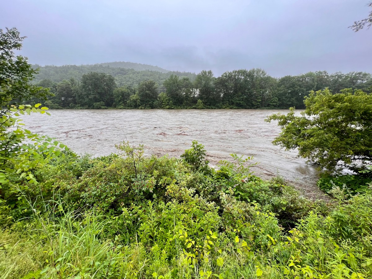
Instead, they stood at the bridge connecting the thoroughfare and the downtown area, watching as giant clumps of tree limbs, sticks and a few trunks hurtled down a hugely swollen, brown White River.
“I wanted to see nature in action,” said Hashimoto, whose home is on higher ground nearby.
He joked about crying “Wilson!” to a volleyball that scooted past, but mostly he noticed the natural debris (as apparently did Oreo, a Teddy Roosevelt terrier, who eyed the water intently).
“A whole forest is floating down the river,” Hashimoto said.
The National Weather Service added the White River to its list of flood warnings earlier in the afternoon, with special attention on West Hartford, the rural village about 9 miles west that was hit hard during Tropical Storm Irene in 2011.
Several other rivers around the state have reached minor flooding stages.
David Fairbanks Ford, the proprietor of the Main Street Museum on Bridge Street, said he had seen concerning signs on another river — the Ottauquechee along Route 4 in Quechee and Woodstock — earlier in the day. But he was feeling OK about the state of the White River as of about 3:45 p.m.

The museum was heavily damaged during Irene, but the rain patterns seemed to be different during that storm, he said. Still, he considered the river’s conditions in West Hartford to be a barometer for the rest of the river downstream.
“When they say the White River’s crested and going down” in West Hartford, he said, “that’s when I’ll be happy.”